×
Sign in
Sign in to save favorite properties and equipment, save your search parameters and more
Don’t have an account yet? Sign Up Now
Sign up
Already have an account? Login Now
Sign in
Sign in to save favorite properties and equipment, save your search parameters and more
Don’t have an account yet? Sign Up Now
Sign up
Already have an account? Login Now
Sign in
Sign in to save favorite properties and equipment, save your search parameters and more
Don’t have an account yet? Sign Up Now
Sign up
Already have an account? Login Now
Sign in
Sign in to save favorite properties and equipment, save your search parameters and more
Don’t have an account yet? Sign Up Now
Sign up
Already have an account? Login Now
If you own land, knowing how to find and check property lines isn’t optional. It’s one of the most practical things you can do to protect what’s yours. Most landowners go years without thinking about it, right up until they’re planning a fence, staring down a neighbor dispute, or getting ready to sell. That’s when a fuzzy sense of “somewhere around that old post” stops being good enough, and you actually need to be able to look up and determine your property lines.
This guide covers every method, from free online tools to hiring a licensed surveyor, so you know exactly how to find your property lines and what to do once you have. We’ll also cover how to check property lines against official records, how to determine property lines when a neighbor dispute comes up, and when a professional survey is worth every dollar.

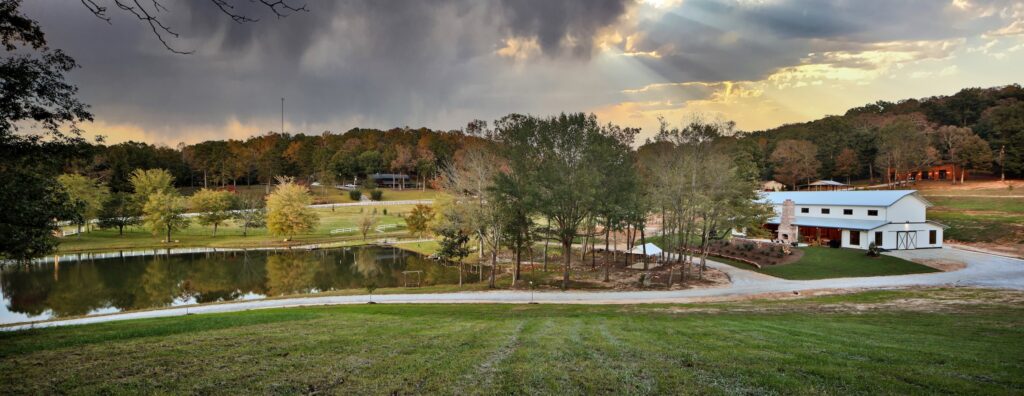
Land means something. It’s not just square footage on paper. For most of us at Hayden Outdoors, land is a way of life, and that’s exactly why the details matter.
Your property lines are the legal edges of everything you own. Get them wrong, and you may build a shop in the wrong spot, lose ground to a neighbor who’s been encroaching for years, or blow up a deal at closing because the survey came back with surprises.
Here are the situations where landowners run into real trouble every year when they don’t correctly find their property lines:
Knowing how to find and check your property lines protects your investment, your rights, and your relationship with the people on the other side of the fence.
Before you go looking into how to determine your property lines, it pays to understand where they come from.
Property lines are the legally defined boundaries of your parcel. They were established when land was originally subdivided by a licensed surveyor who recorded those measurements with the county. Every deed, sale, and transfer since then has referenced that original legal description.
Fences are not property lines. This is probably the most common misunderstanding in rural real estate. A fence is where somebody decided to put a fence. It might follow the property line exactly, or it might wander several feet off in either direction. Never assume that you can find your property lines solely by using a fence line; checking with a surveyor will be key.
The same goes for hedgerows, tree lines, ditches, and driveways. They’re features on the ground, not legal documents. You can reliably use them when determining how to find your property lines.
Easements are not property lines either. An easement gives another party the right to use a portion of your land for a specific purpose, typically a utility corridor or shared access. That land is still yours, but what you can do with it may be limited. Easements are recorded separately and show up in your deed or at the county recorder’s office. When you check your property lines, also check for easements.
Setbacks shrink your buildable area. Even once you know your property lines and how to find them, setbacks, which are the minimum distances structures must sit from a line, road right-of-way, or waterway, reduce where you can actually build. Always check your county’s zoning regulations before you break ground.

One of the most common questions we hear is how to look up property lines for free, before spending money on anything else. While there’s plenty of useful information online, just know upfront: online tools show approximate lines, not legally binding ones. Use them to get oriented, but you’ll want to be more precise before you take any action based on what you find out about your property lines.
County Assessor or Recorder Website: Your county assessor keeps records on every parcel in the county, including ownership information, parcel numbers, and often basic maps. Search for your county’s assessor website, enter your address or parcel number, and look for a parcel map or plat viewer. This is usually the fastest free way to look up property lines and get a general picture of your boundary shape.
County GIS Portal: Most counties now run a Geographic Information System that layers parcel boundaries over aerial photography. You can zoom to your parcel, toggle layers, and sometimes export coordinates. It’s one of the quickest ways to find and check property lines at a glance. Still a reference tool, not a legal survey.
Third-Party Parcel Tools: Platforms like Regrid aggregate county parcel data into one searchable interface. Basic viewing is often free. If you’re looking at a piece of ground you’re thinking about buying, these tools are a practical starting point to find property lines and understand the parcel’s shape and neighbors.
A plat map is the official recorded map of a subdivision or land division. It shows lot boundaries, lot numbers, street dedications, easements, and the bearings and distances of each line. Plat maps are recorded at the county recorder’s office and are often available online through the same GIS or assessor portal. Learning to read one is one of the most useful skills for anyone who wants to find property lines on their own.
Pro Tip: Online maps and GIS tools pull from recorded plats and deeds. They don’t reflect a fresh survey of your land. Lines can be off by several feet or more, depending on how old the original survey was and how the data was digitized. Cross-reference at least two sources when trying to find your property lines, before drawing any conclusions.

Your deed is the most direct written record of how to find property lines for your specific parcel. If you’ve purchased land, your deed was recorded at closing. If you have access to these closing documents, that’s a great place to look.
If you need to get a copy of your deed, your county clerk and recorder or the title company you went through are also sources.
Older farms and ranches typically use a metes and bounds description to determine property lines. It’s a narrative that starts from a point of beginning and traces the boundary using directions and distances, returning to where it started.
Something like: “Beginning at the iron pin at the northwest corner of the Southwest Quarter of Section 14; thence South 89 degrees 43 minutes East, 1320 feet to an iron pin…” and so on around the perimeter.
Walking this description with a compass and measuring tape gives you a reasonable field approximation of your property lines. A licensed surveyor will always be more accurate, but this gets you in the ballpark.
Platted properties use a lot and block system that references a recorded plat. Something like: “Lot 4, Block 2, Prairie Ridge Estates, as recorded in Plat Book 12, Page 47, [County] County.” Find that recorded plat at the county, and you find your property lines.
If your deed description reads like a foreign language, call your title company. They have your title policy and the supporting documents, and they can usually walk you through the boundary description in plain terms. If there are questions about overlapping claims or gaps in the chain of title, bring in a real estate attorney.
One more thing worth knowing: if your deed references a survey from several decades ago, the county recorder can often pull a copy of that original document. Old rural parcels were sometimes surveyed using landmarks that no longer exist, such as a particular tree, a fence post, or a creek bank that’s since moved. When you’re trying to determine property lines from a description that old, a surveyor who knows historical methods is worth the investment.

Once you’ve done your records research, you can start checking property lines on the ground. This is where paper meets dirt, and for a lot of landowners, it’s the most satisfying part of the whole process.
When a licensed surveyor sets a boundary, they place physical markers at property corners and sometimes at points along the lines. Here’s what to look for when you’re trying to find your property lines in the field:
Markers are usually set at or just below the ground surface. Soil builds up, vegetation moves in, and equipment knocks things around. Don’t be surprised if they’re hard to find.
A metal detector is one of the most practical tools for finding buried iron pins on your own. Walk the perimeter suggested by your deed or GIS map, scan near expected corners, and flag anything that registers. This works well on properties where a prior survey was done, but the pins have settled below the surface.
Important Note: Before you use a probe rod, dig with a shovel, or break ground anywhere in search of buried markers, call 811, the national call-before-you-dig number. It’s free, it’s required in most states before any digging project, and it gets utility companies out to mark buried lines in your area. Call a few business days before you plan to work to find your property lines. Don’t skip this step.
With your deed description and a compass app, you can walk a rough version of your boundary using a measuring wheel or GPS unit. This is not a substitute for a survey, but it gives you a solid working sense of where your property lines run relative to features on the ground.
Markers disappear. Equipment knocks them out. Grading work buries them. Sometimes people remove them when they should have known better. If you can’t locate a pin where the deed says one should be, don’t guess and don’t set your own. That’s a licensed surveyor’s job. Setting your own pins is not how to find property lines legally. It’s how you create a bigger problem.

For changes on your property that require certainty, the answer is a licensed land surveyor. Doing your own research is worthwhile, and knowing how to check property lines on your own will save you time and money. But a professional survey is the only method that produces a legally defensible result. It’s what permits, disputes, and most real estate transactions require.
A boundary survey means a licensed surveyor researches your deed, prior surveys, and adjoining property records, then goes into the field to locate or set corner monuments. The result is a plat or map showing the property lines, any encroachments, easements, and relevant features. In most states, it’s signed, stamped, and can be recorded at the county.
A boundary survey is what pins your corners to the ground and gives you a legally defensible map of exactly where your property lines begin and end. It’s what most landowners need when they want a definitive answer about where their property lines fall relative to structures, fences, or a neighbor’s improvements.
A mortgage or location survey (sometimes called an improvement location certificate, or ILC) tells you roughly where your buildings and structures sit in relation to your property lines, but it won’t give you the precision of a full boundary survey, and most states won’t treat it as a legal substitute for one.
A topographic survey adds elevation and contour data. It’s useful for drainage planning, construction, and conservation easements, but it doesn’t tell you how to find your property lines (unless you’ve paired it with a boundary survey).
If you’re not sure which type of land survey you need, describe your situation to the surveyor when you call. A good one will tell you straight.
Your state’s board of professional land surveyors keeps a roster of licensed practitioners. You can also ask your county recorder’s office, your title company, or a land specialist at Hayden Outdoors for referrals. When you reach out for quotes, be specific about your parcel size, the age of the last survey, and what you need the result for. Cost varies depending on acreage, terrain, and deed complexity.
Certain situations require a formal survey to find and check property lines, no question about it. Building permit applications near a property line, subdividing land, creating a new parcel, adjusting a shared boundary, and most land sales will all trigger a survey requirement at some point. If your last survey is more than a decade old, or if you have any reason to think markers are missing or disputed, get a new one before you list.
For landowners who want to look up property lines before calling in professionals, a few specific resources are worth bookmarking.
The Bureau of Land Management’s General Land Office Records portal at glorecords.blm.gov offers historical survey plats and field notes for much of the western United States going back to the original government surveys. If you’re trying to find your property lines or determine property lines on older western ranch and farm ground, this is an excellent free place to start.
Your county assessor’s or treasurer’s website is the standard starting point for parcel-level information. Most counties link from there to a GIS viewer. If yours doesn’t, search “[county name] parcel viewer” and you’ll almost always find it. This is how most landowners look up and determine their property lines for the first time.
Title search platforms used by real estate professionals can show the chain of title history and recorded instruments, including deeds, easements, and covenants. Many county recorder portals give the public access to these at no charge.
When you look up property lines online, always cross-reference two sources. A GIS viewer and a recorded plat often don’t agree exactly, and understanding why that is tells you something useful about the history of that ground.

Good neighbors end up on opposite sides of boundary questions all the time. An old fence that was never surveyed. A driveway that crept a few feet over the property line. A tree that straddles a line nobody marked clearly. When that happens, knowing how to find property lines accurately and how to determine property lines from official records is what keeps a disagreement from becoming a legal fight.
Start With Records, Not Arguments: If you suspect an encroachment, pull your deed, find your plat, and find the last recorded survey of your property lines. Then have a calm conversation with your neighbor before involving anyone else. Most boundary disagreements get resolved at this stage, especially when one side can show documentation of where to find the property lines that the other side never knew existed.
Get A Survey: If records don’t settle it, a survey will. The most reliable way to determine property lines in a dispute is with a licensed surveyor whose findings carry legal weight. Both parties should understand that the surveyor’s determination is the authoritative answer. If you can both agree to share the cost of a jointly commissioned survey, even better.
An encroachment is when someone’s improvement physically crosses onto your property without permission. A fence that meanders over the neighboring property line onto your land. A driveway apron. A retaining wall. A building corner.
Encroachments matter beyond the obvious because of a legal doctrine called adverse possession. Under that doctrine, someone who occupies land belonging to someone else in an open, continuous, exclusive, and hostile manner for a period defined by state law may be able to claim legal title to it. That period varies significantly by state.
The bottom line: if someone has been using a corner of your ground like it’s theirs, and you’ve done nothing about it for a long time, you could lose it. Knowing how to find your property lines and keeping an eye on them isn’t just about building permits. It’s about protecting your ownership.
If a survey confirms an encroachment and your neighbor won’t accept it, or if competing deed descriptions create real ambiguity about where your property lines fall, you need a real estate attorney. A quiet title action is the legal process for resolving disputed ownership, and that’s not a DIY job.

Finding your property lines is the first half. Protecting that knowledge long-term is the other half. A lot of people go through the trouble of a survey and then let the paperwork sit in a pile, and that’s not a risk worth taking.
Document It: Photograph each corner monument, including the pin itself, the surrounding ground, and GPS coordinates from your phone. Store copies of your survey, deed, and plat somewhere you can actually find them. A fireproof box or a scanned digital backup both work. If you ever need to check your property line again down the road, this saves real time and money.
Replace or Install Permanent Markers: If your surveyor reset corners as part of the survey, that’s covered. If you want to make those corners easier to find in the future, ask your surveyor about appropriate marker types for your terrain and whether local permits are needed before installing anything.
Tell Your Neighbors: Share a copy of your survey with adjacent landowners. This costs nothing and prevents a lot. People who know where the property lines fall don’t accidentally build on them. It’s also just a solid way to keep good relationships with the people you share fences with.
Record It at the County: If your surveyor produced a new plat, ask whether it should be recorded at the county recorder’s office. Recorded surveys become part of the permanent public record and protect your property lines for future owners.
File It With Your Deed: Treat your survey like you treat your deed. Future buyers, lenders, heirs, and attorneys will all be better off for having a clear, current record of your property lines on file, without having to dig to find them.
We’ve been in the business of land since 1976. Hayden Outdoors brokers and agents don’t just sell land, they work it, hunt it, and understand it. When property lines come up in a transaction, whether it’s a boundary question on a ranch you’re looking at buying or making sure a property you’re selling is clean and market-ready, that knowledge matters.
The nuances of legal descriptions, survey requirements, water rights, and easements aren’t footnotes when you’re buying or selling rural real estate. They’re the foundation of the deal. Working with someone who understands how to find and check property lines in the field, not just on paper, is the difference between a transaction that closes well and one that doesn’t.
Get In Touch With A Hayden Real Estate Agent